Resources
At OpenDRI we are committed to increasing information that can empower individuals and their governments to reduce risk to natural hazards and climate change in their communities. We’ve compiled a database of relevant resources to share what we have learned through our own projects and from the work of others.
Guides and Publications
-
 28 Apr 2021 Responsible Artificial Intelligence for Disaster Risk Management
The Responsible AI for DRM report highlights the ethics and responsibility concerns in AI- and ML-supported projects, such as algorithmic bias, transparency and privacy issues, and reduced roles for local participation and expert judgment.
 15 Oct 2020 Open Cities Africa Final Report
The Open Cities Africa final report documents the successes, challenges, and lessons learned under the ADRF funded program
-
 14 Feb 2020 Sustainability in OpenStreetMap
The white paper explores the many facets of OpenStreetMap (OSM) in development and the challenges of striving for “sustainability” in the wider mapping ecosystem – the paper also examines the factors that influence long term success of work involving OSM in a development context.
 14 Dec 2019 Managing the Risks of Unmanned Aircraft Operations in Development Projects
From an origin in military and security applications, the use of unmanned aircraft (UA) technology is currently transforming commercial and humanitarian activity. Its evolution started many decades ago, but was limited by the technology of the time; in recent years, advances in this area have facilitated an increasingly rapid expansion of UA technology that has started to move into a variety of sectors. As the societal benefits of UA become clearer, organisations across the commercial and government spectrum seek to exploit the technology to improve their business models and offer a safer, cleaner, and more cost-effective alternative to traditional data-capture methods.
-
 21 Dec 2018 Machine Learning for Disaster Risk Management
This guidance note explains how the World Bank Group uses machine learning algorithms to collect better data, make more informed decisions, and, ultimately, save lives.
 14 Nov 2018 Planning An Open Cities Mapping Project
This Open Cities guide documents lessons learned from work in South Asia, providing an overview of the design and implementation of a community mapping program. To keep this guide up-to-date and truly open source, the online version of the document is hosted on GitHub welcoming comments and contributions.
-
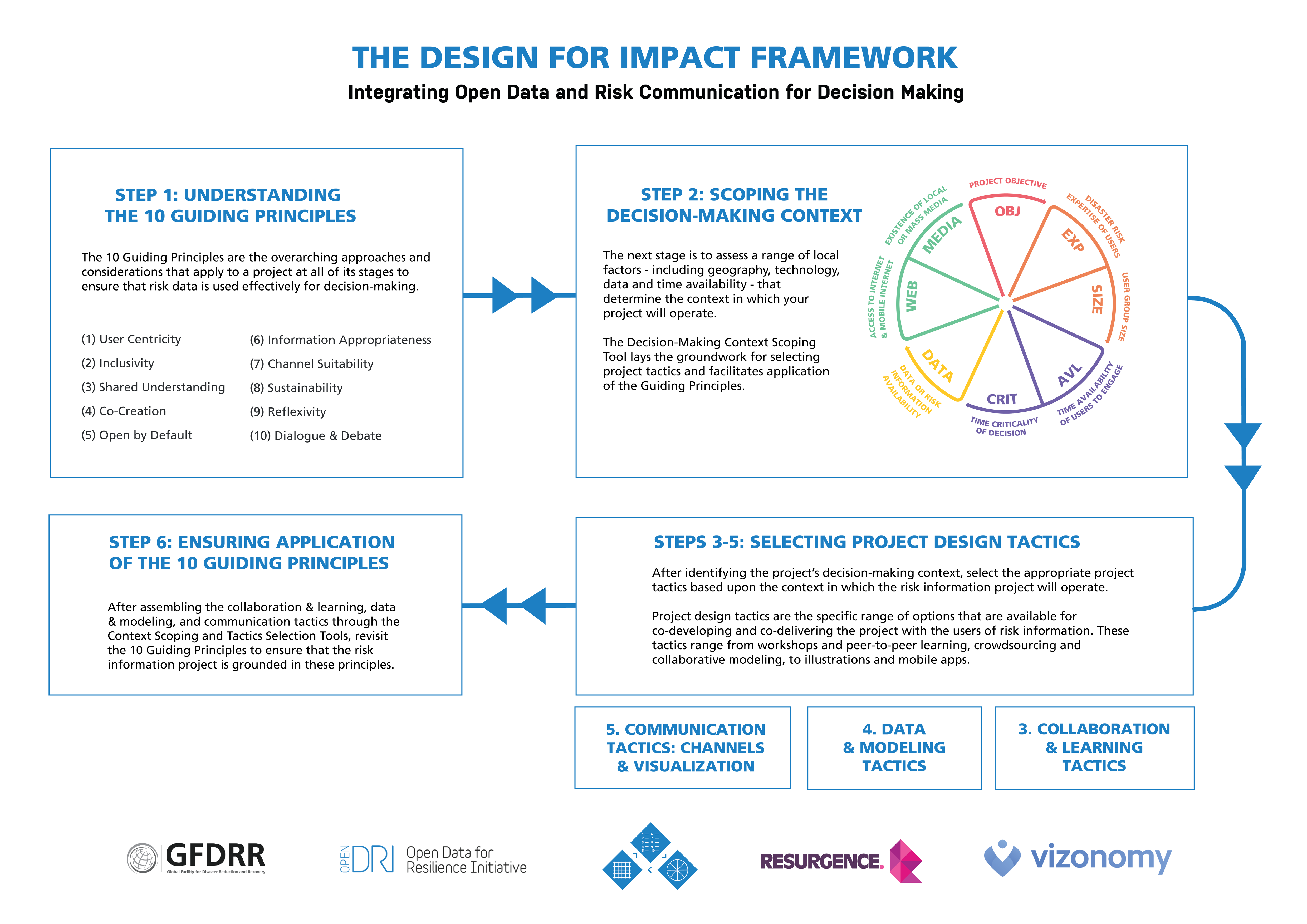 14 May 2018 Design for Impact: Integrating Open Data and Risk Communication for Decision-Making
A new resource for project designers working with risk data and information. It aims to provide project designers with a framework to guide them in developing projects that have a strong link between development of open risk data and real world decision-making.
 14 May 2018 Identifying success factors in crowdsourced geographic information use in government
The aim of this updated report is to review governmental projects that incorporate VGI and provide information that can be used to support its wider adoption of VGI. To this end, the report compiles and summarises lessons learned and successful models from government projects in different sectors and at different levels.
-
 1 Dec 2017 Demystifying Satellite Assets for Post-Disaster Situation Awareness
This is a living document that aims to demystify the numerous satellite assets available to the emergency response community. It is published openly on Google Docs, accepting comments, corrections, and criticisms from interested readers.
 30 Nov 2017 Open Mapping for the SDGs: A practical guide to launching and growing open mapping initiatives
This guide, drawing from the Open Cities guide, provides resources to help national bureaus of statistics, national mapping agencies, line ministries, and non-government partners foster the growth of participatory mapping in their countries and develop national roadmaps.
-
 24 Mar 2017 OpenDRI & GeoNode: A Case Study for Institutional Investments in Open Source
This report examines the history of the GeoNode software project from its inception, tracing how GFDRR contributed to the project’s success.
 19 May 2016 OpenDRI Policy Note & Principles
This publication describes the approach taken by the OpenDRI team to design and enact impactful and sustainable projects with our partner organizations and communities.
-
 9 Nov 2015 Crowdsourced Geographic Information Use in Government
This report, Crowdsourced Geographic Information Use in Government, is based on a six-month study of the use of volunteered geographic information (VGI) by government.
 4 Jun 2014 Open Data for Resilience Initiative Field Guide
The Open Data for Resilience Initiative Field Guide highlights the use of GeoNode and crowdsourcing, and is aimed at practitioners considering how open data may support a DRM project.
Tools and Training Materials
-
 10 Feb 2017 Introduction to OpenDRI E-Learning Course
This short, self-paced e-learning course provides an overview of the approach and toolset developed by the Open Data for Resilience Initiative.
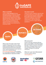 23 Aug 2016 Introduction to InaSAFE
Learn more about InaSAFE, a free software that produces realistic natural hazard impact scenarios for better planning, preparedness and response activities.
-
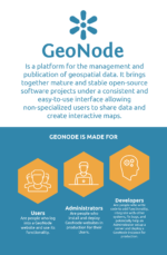 22 Jun 2016 A Glance at the GeoNode
If you're looking to know more about GeoNode, take a glance at the OpenDRI team created. It gives a basic overview of the tool and briefly explains how and why the platform can be used.
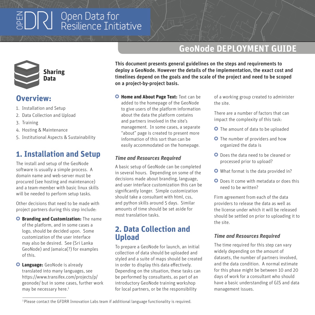 4 May 2016 GeoNode Deployment Guide
This GeoNode Deployment Guide, developed by the OpenDRI team, presents general guidelines on the steps and requirements to deploy a GeoNode.
Short Notes
-
 14 May 2018 Identifying success factors in crowdsourced geographic information use in government
The adoption of crowdsourced geographic data, or volunteered geographic information (VGI), is growing within government. VGI is crowdsourced geographic information provided by a wide range of participants with varying levels of education, knowledge and skills.
-
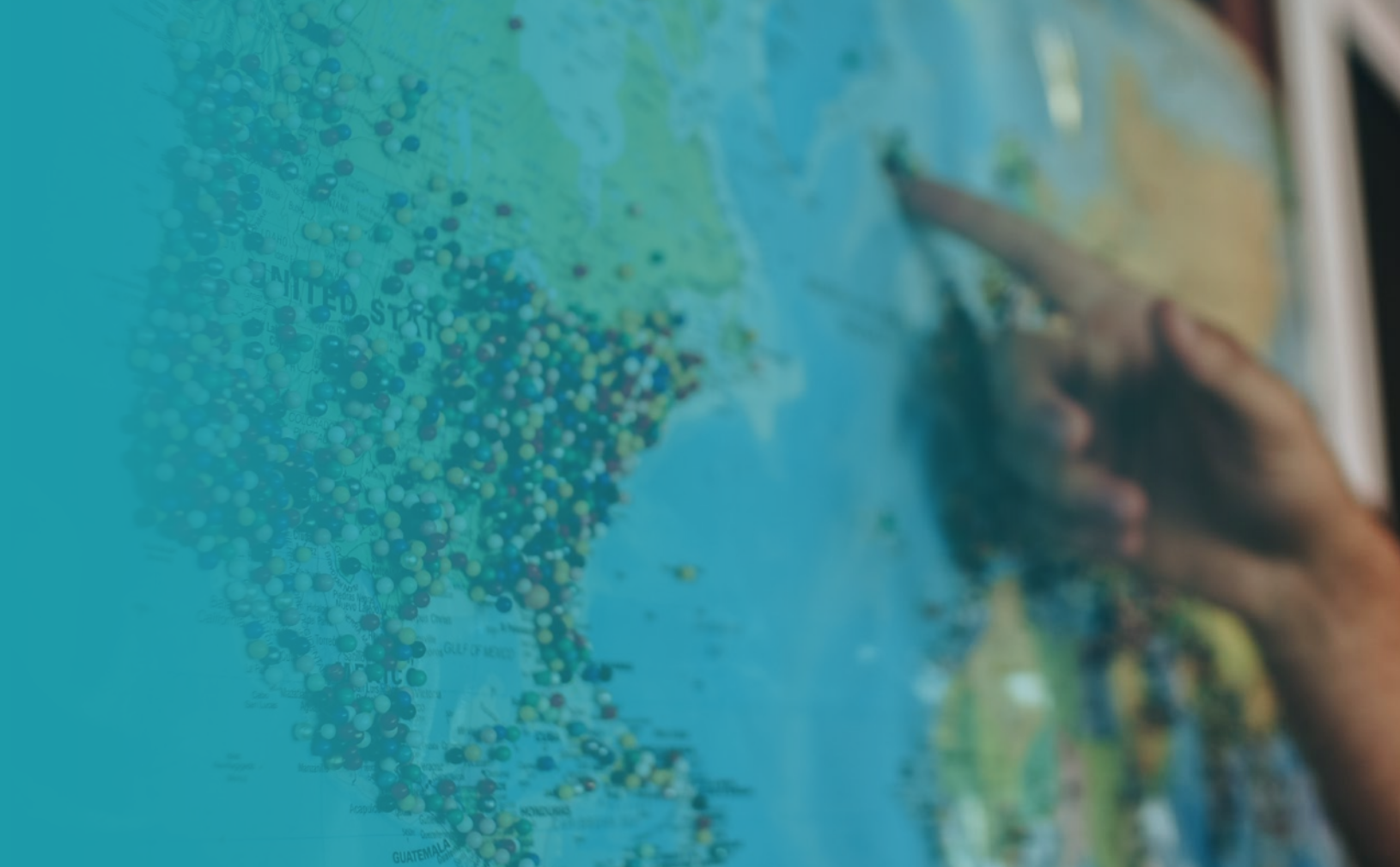
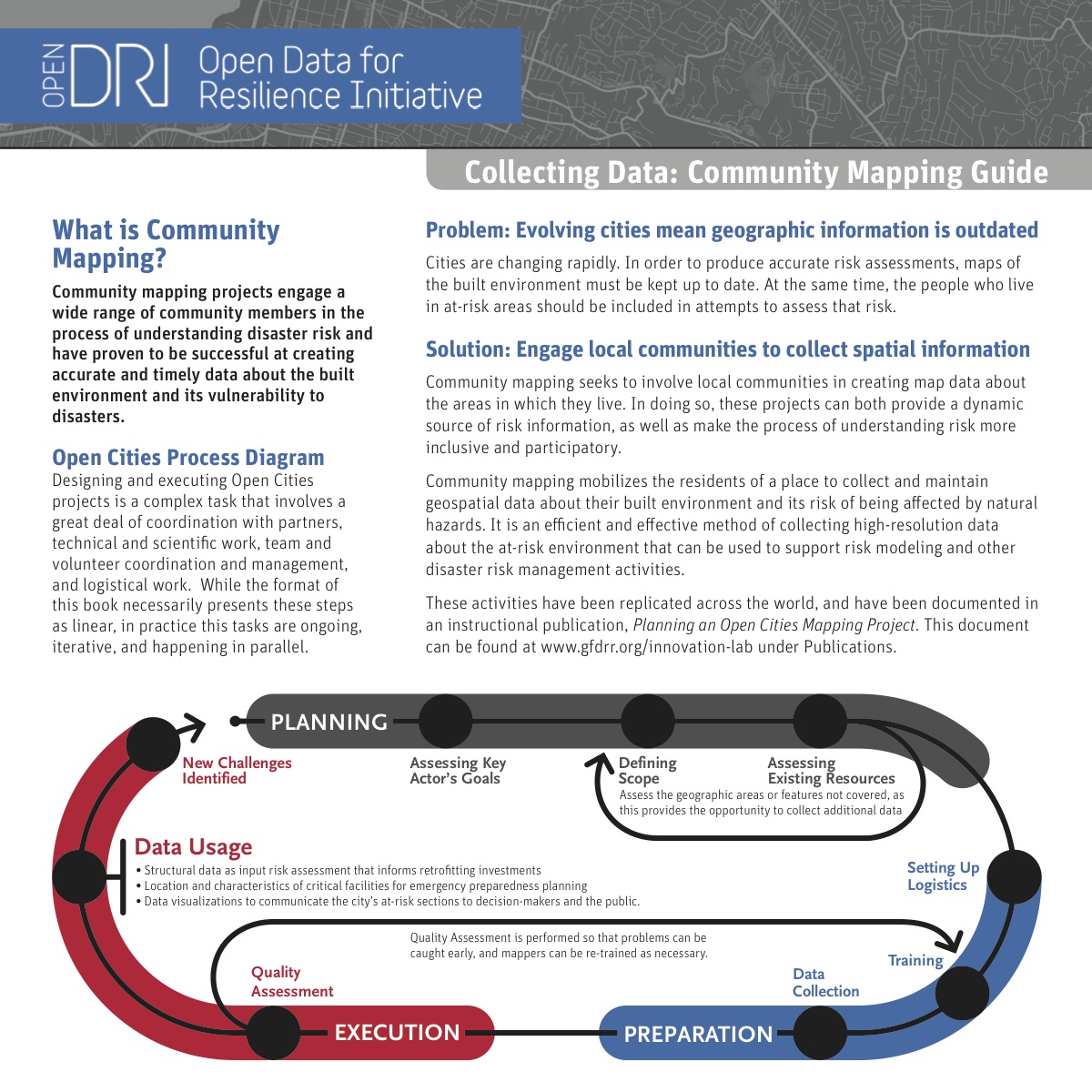 4 May 2016 Community Mapping Factsheet
The Community Mapping Factsheet is a glimpse into the OpenDRI efforts to include people who are exposed to hazards in the data creation process.
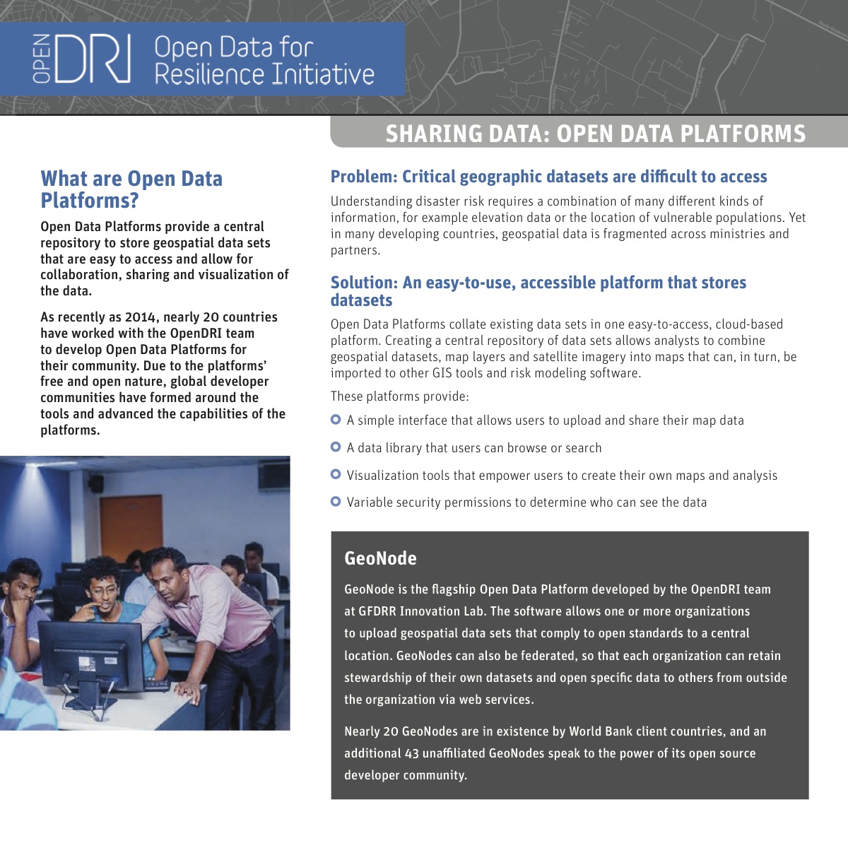 4 May 2016 Sharing Data Factsheet
The Sharing Data Factsheet takes a brief look at how OpenDRI works with Open Data Platforms.

Other Resources
-
 12 May 2016 Satellites in Global Development
Satellites in Global Development is an exploratory overview of current and upcoming sources of data, processing pipelines and data products. The research was compiled by the World Bank Leadership, Learning, and Innovation (LLI) team.
-
 4 May 2016 Review of Open Source and Open Access Software Packages Available to Quantify Risk from Natural Hazards
This Understanding Risk publication created by the GFDRR Innovation Lab aims to highlight modelling tools' strengths and also highlights some of the challenges that a user of a modelling tool might face.
 12 Nov 2015 Shock Waves: Managing the Impacts of Climate Change on Poverty
This World Bank report, created by the World Bank Climate Change team, brings together the two objectives of ending poverty and stabilizing climate change, examining potential impacts of not only climate change but also of climate policies on poverty reduction.
-
 1 Jun 2015 Digital Elevation Models: A Guidance Note on how Digital Elevation Models are Created and Used
This Guidance Note, created by the World Bank Lidar Working Group, aims to compile such knowledge in one publication and thereby address all pertinent topics of DEM creation and use, including a workflow to facilitate the best way to plan a well-informed DEM-mission or proposal, primarily aimed at non-specialists.
 20 Jun 2014 Understanding Risk in an Evolving World
The last ten years have seen marked improvement in disaster risk assessment capabilities and communication efforts. As the period of the Hyogo Framework for Action comes to an end, Understanding Disaster Risk in an Evolving World – Emerging Best Practices in Risk Assessment and its accompanying Policy Note seek to inform the post-2015 discussions. Through an examination of more than 50 case studies, including some from World Bank and GFDRR teams, this reference guide by the GFDRR Innovation Lab offers best practices in the creation, communication, quality, and transparency of risk information. Topics range from satellite earth observations to community mapping and from risk financing to urban disaster risk modeling.
-
 1 Jun 2013 Open Data for Resilience Initiative (OpenDRI): Overview
The goal of this Overview Report, published in May 2013, is to communicate the vision, approach and impact of the Open Data for Resilience Initiative (OpenDRI).
